Conservation Projects & Programs
In addition to protecting land, the Central Algoma Land Trust undertakes projects and programs in the Central Algoma region that support nature and the environment.
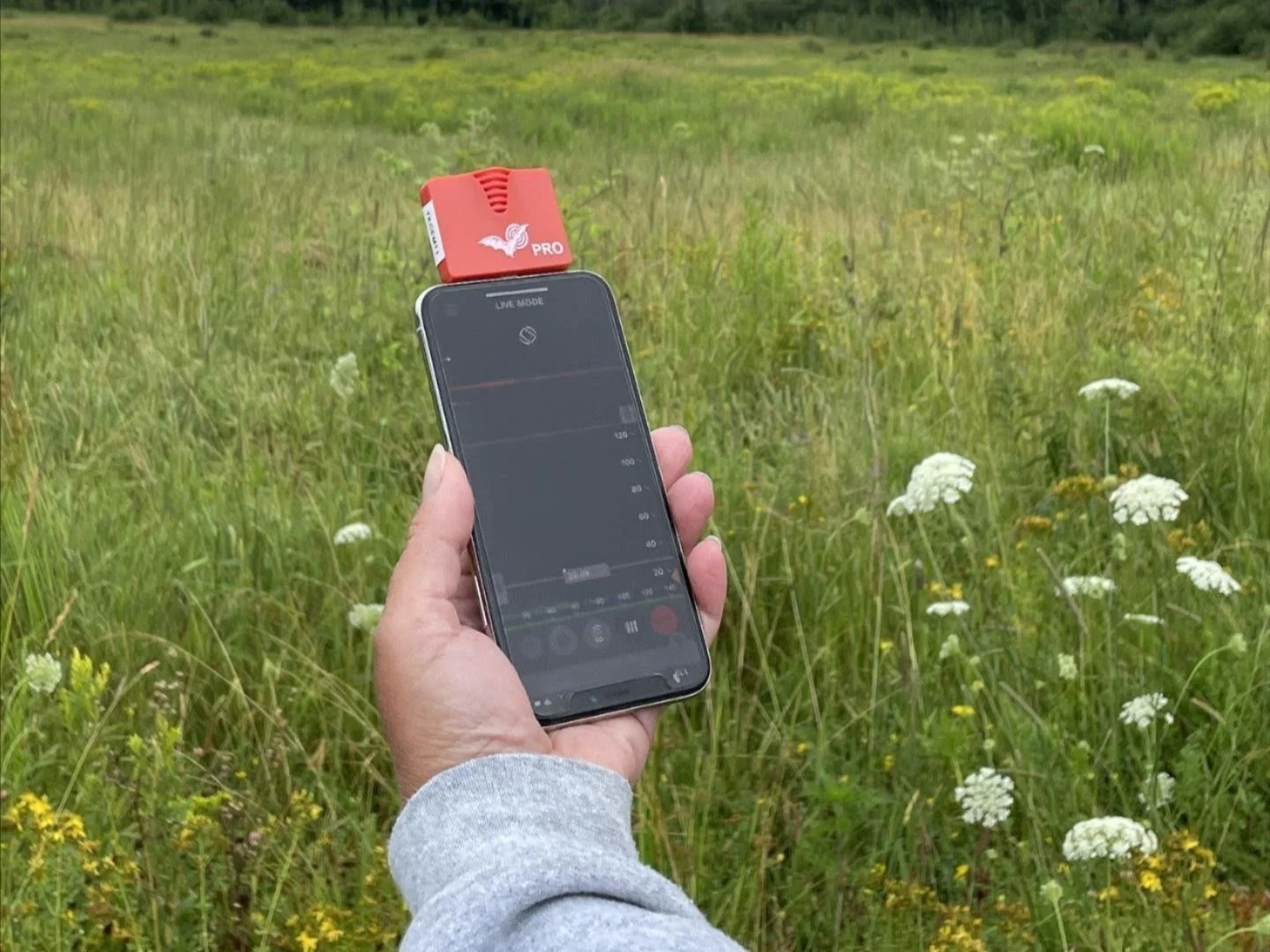
Bat Monitoring and Education Program
The Bat Monitoring and Education Program helps track local bat populations using specialized acoustic recording devices placed throughout the Central Algoma region. Volunteers and staff collect data that is analyzed to better understand bat activity and species presence. This information contributes to long-term conservation efforts and supports national bat monitoring initiatives.
Water Quality Monitoring Program
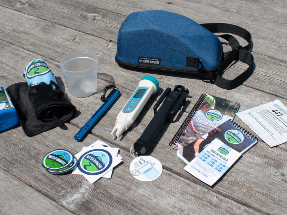
The Water Quality Monitoring program engages volunteers in regular testing of lakes and streams to assess ecosystem health and safety for recreational use. Participants gather water samples to analyze parameters like clarity, nutrients, and contaminants. The data helps identify trends, inform conservation efforts, and guide land and water management decisions. It’s a hands-on way for community members to contribute to protecting and improving local water bodies.
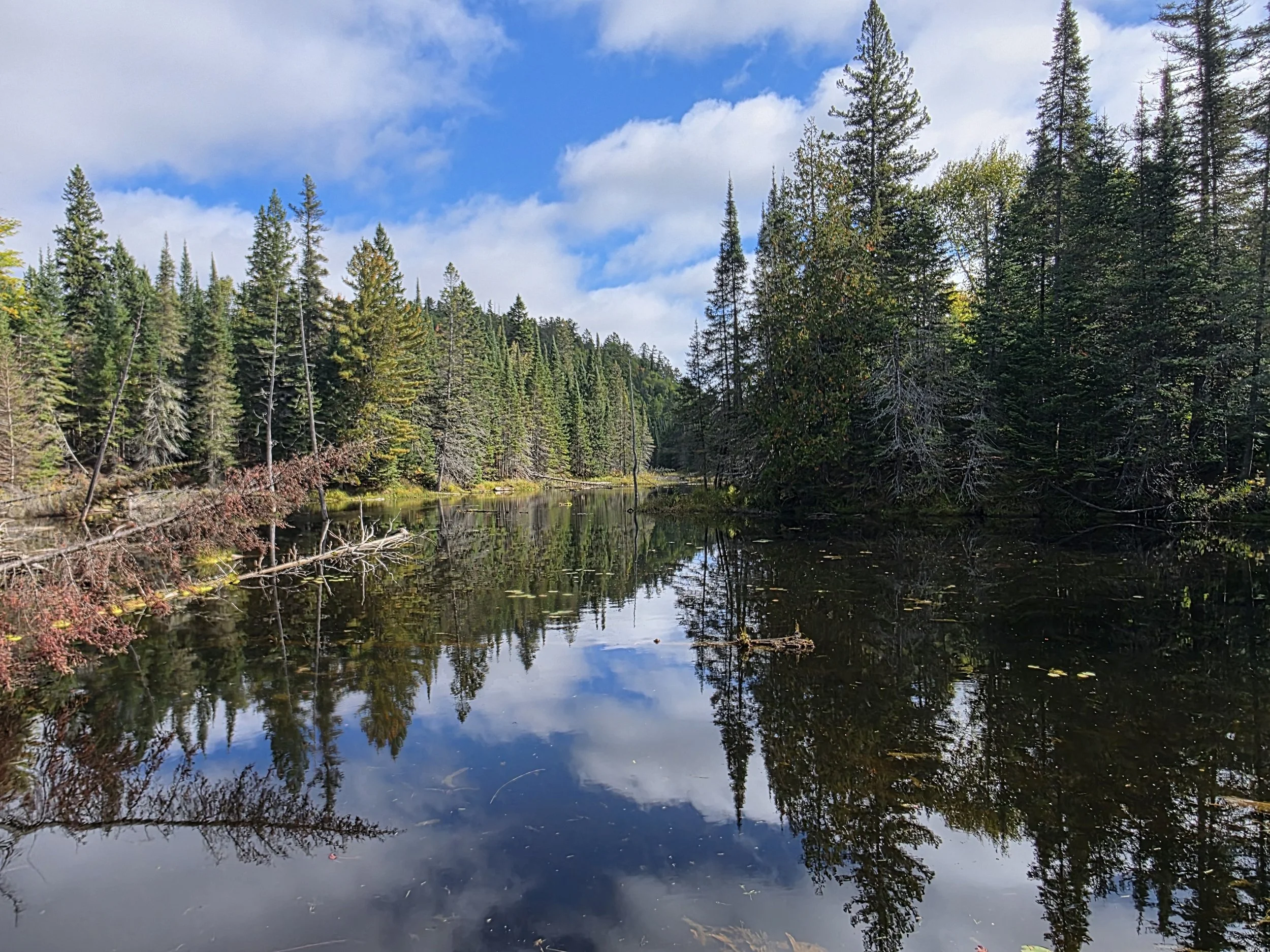
Sault Ste. Marie and Garden River Priority Area for Ecological Corridors Project
Parks Canada chose the Sault Ste. Marie and Garden River area as a National Priority Area for Ecological Corridors as the lands around the city are essential to landscape connectivity within the Great Lakes Basin. It is a key location for wildlife to move north-south around the east end of Lake Superior and the west end of Lake Huron, making it a critical point for terrestrial wildlife movement. The Central Algoma Land Trust is working with a number of other like-minded organizations and individuals to map and establish ecological corridors in the area.
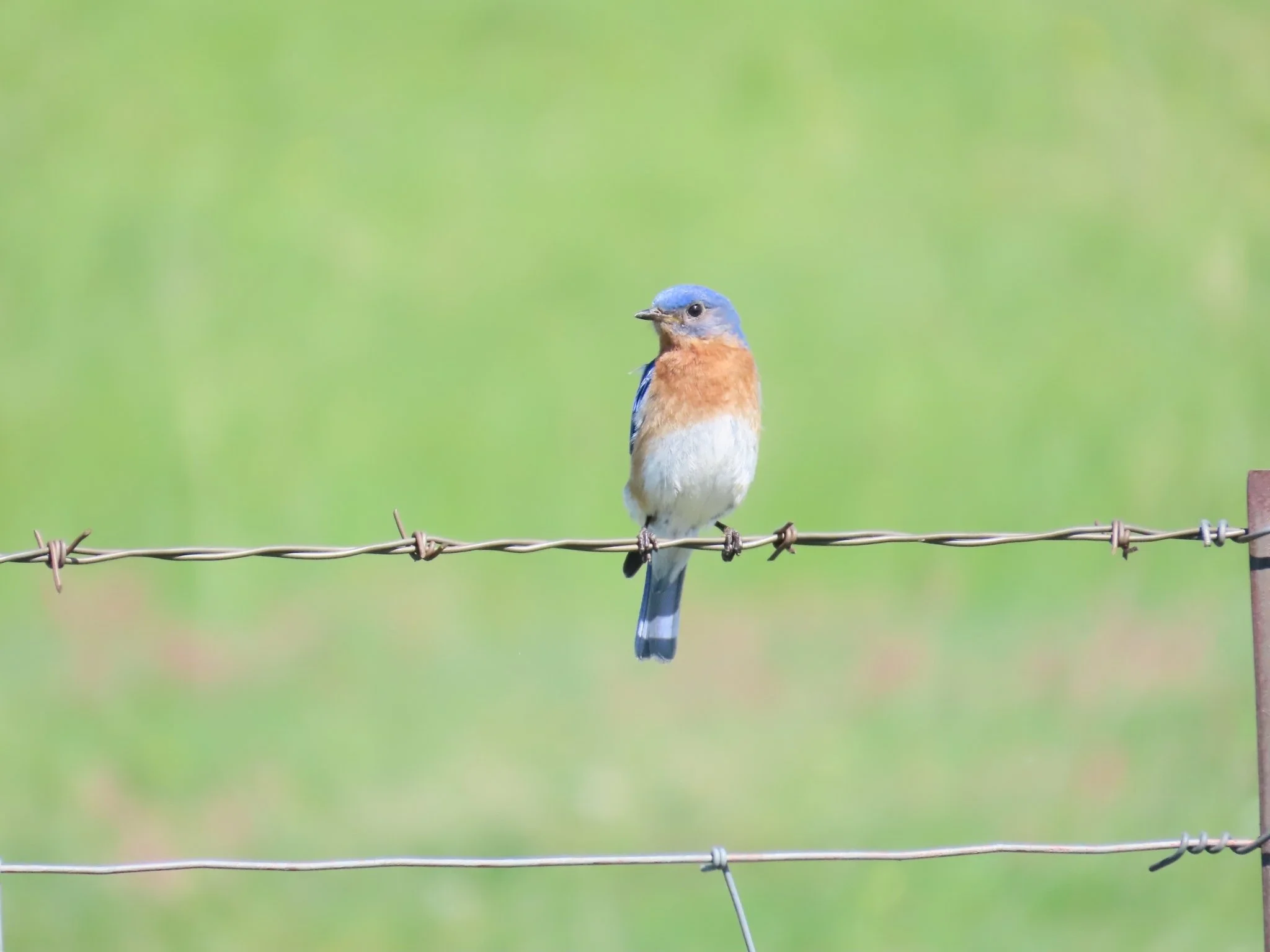
Bluebird Box Monitoring Program
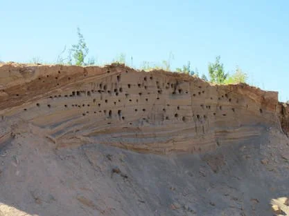
The Eastern Bluebird Trail is a partnership with Algoma University to support cavity-nesting birds in the Desbarats area. Fifty nest boxes were initially installed on both our nature preserves and private properties and are monitored throughout the breeding season. Eastern Bluebirds, Tree Swallows, Northern House Wrens, and Black-capped Chickadees have all successfully used the boxes. Volunteers are needed each year to help monitor and maintain the trail.
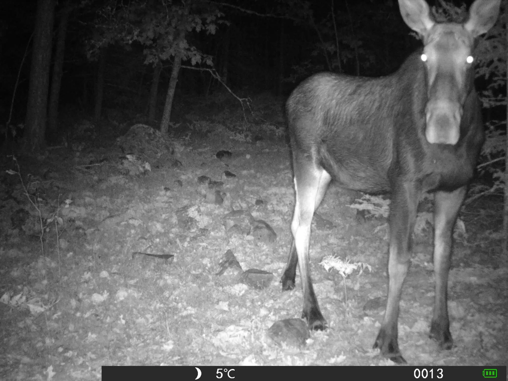
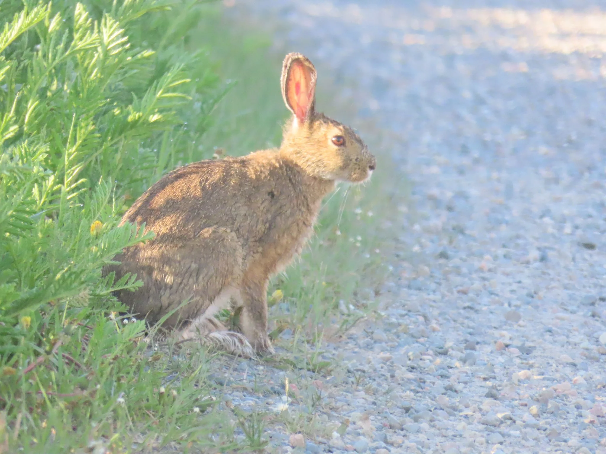
Trail Camera Program
Installing trail cameras is an invaluable way to document wildlife in our protected areas, capturing animals that are often elusive or active at times when people aren’t around. These cameras help us learn about species presence, behaviour, and habitat use, providing data that is essential for conservation planning.
Desbarats Christmas Bird Count
The Desbarats Christmas Bird Count is a single-day event held each year in late December as part of North America's longest-running citizen science initiative. Participants record every bird seen within a 12 km radius, either as field observers or by watching feeders at home. The data collected helps scientists monitor bird populations and distribution across the continent. This annual count is a fun and meaningful way for community members to contribute to bird conservation.
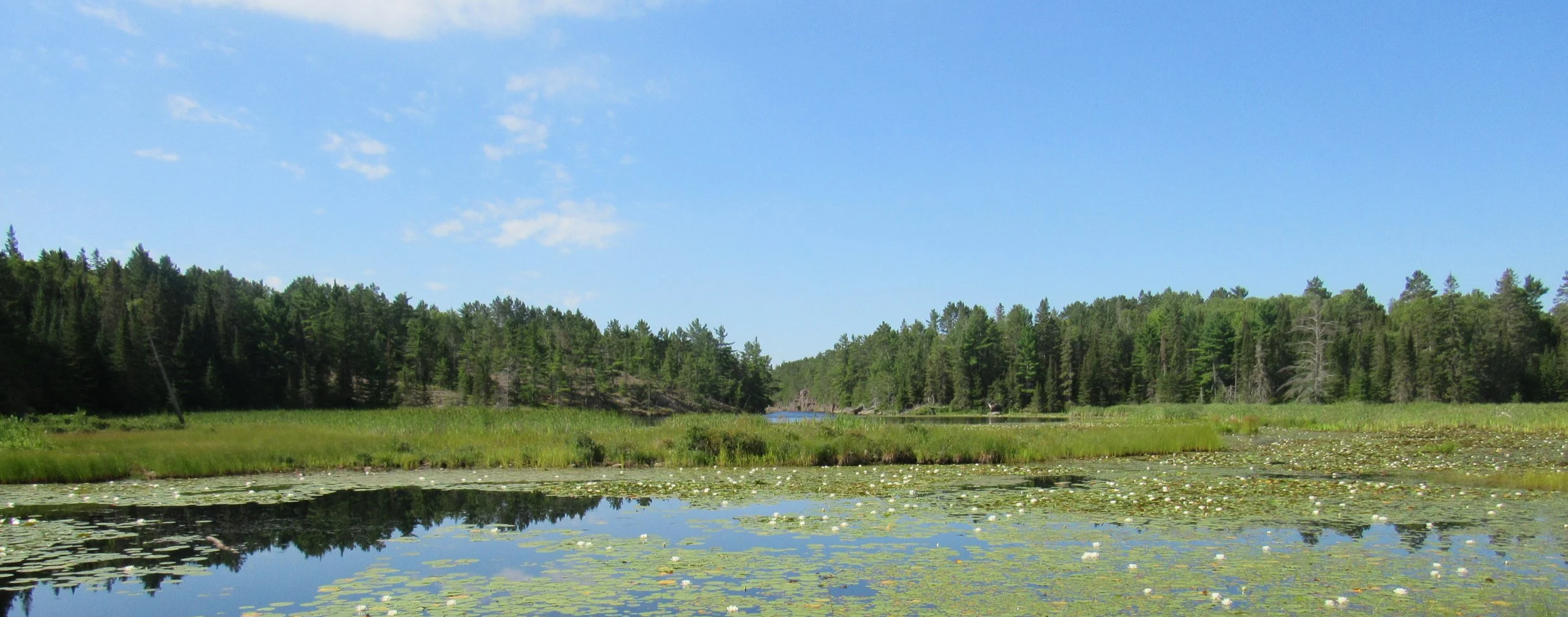
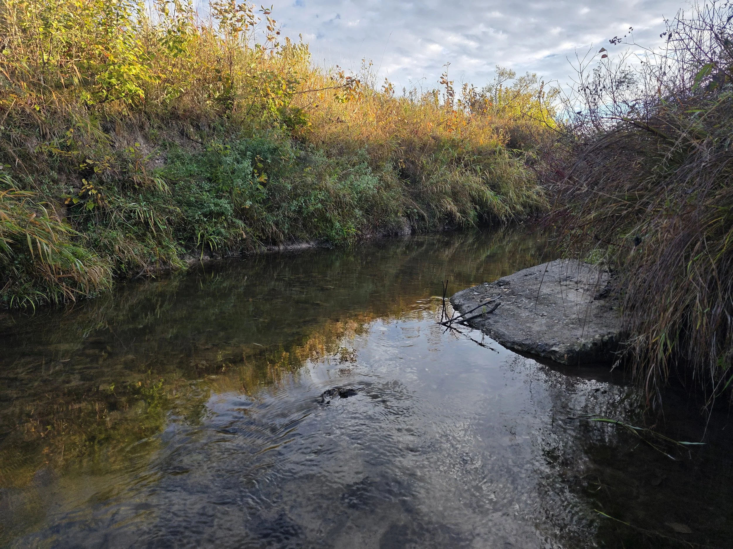
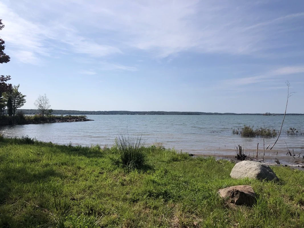
Two Tree River Key Biodiversity Area
We helped develop the proposal to establish the Two Tree River as a Key Biodiversity Area. Located on St. Joseph Island, the Two Tree River supports a nationally significant population of Redside Dace, an endangered minnow in both Ontario and Canada. Redside Dace are highly sensitive to changes in stream flow and declines in water quality, and as a result its national population has been decreasing.
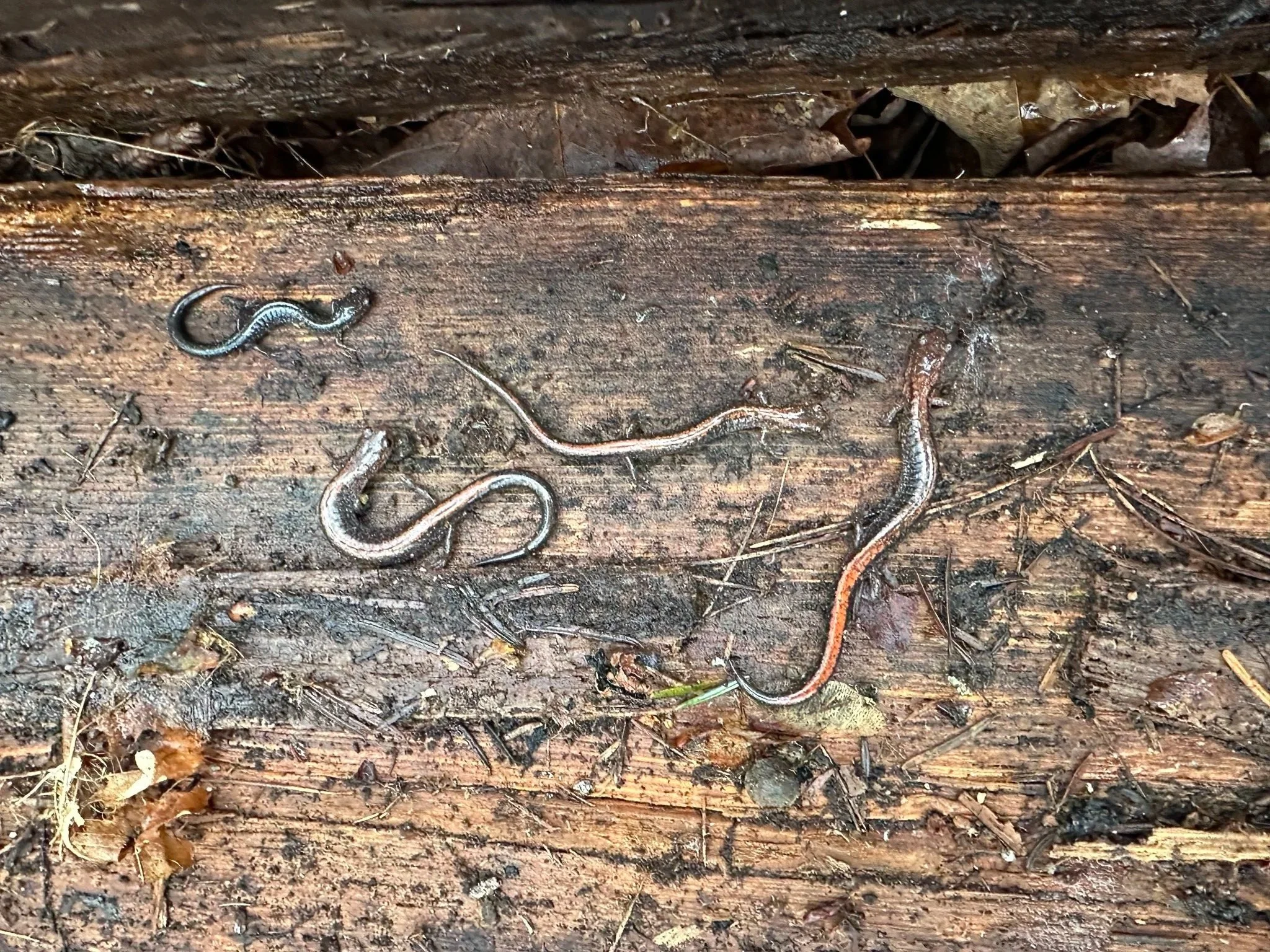
Salamander Board Program
At the Gravel Point Preserve, we use a series of twenty wooden “salamander boards” placed directly on the forest floor to create cool, moist microhabitats that amphibians like to shelter under. By lifting and inspecting these boards throughout the season, we can document which salamander species are present and how their populations may be changing over time.
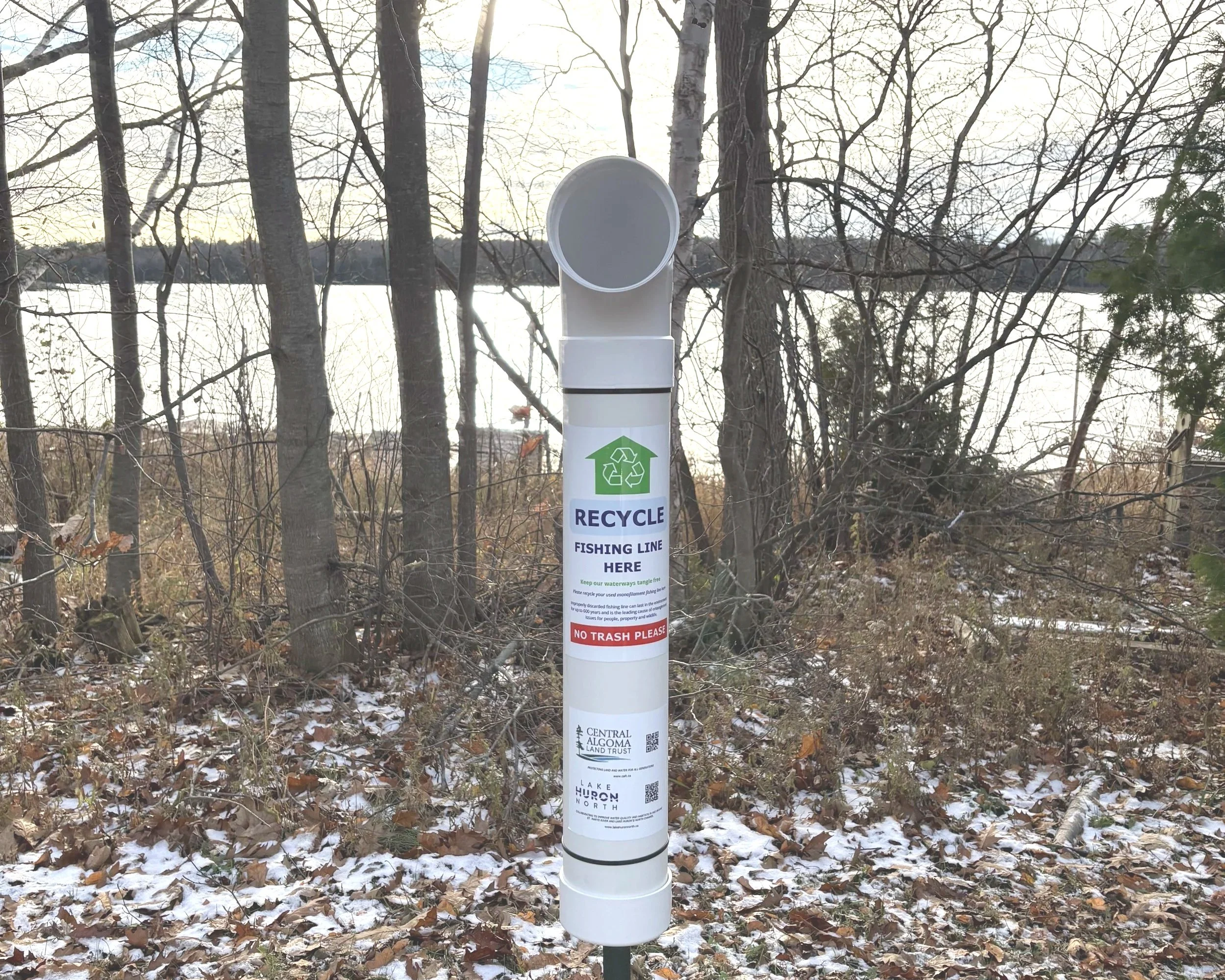
Fishing Line Recycling Station Program
Our Fishing Line Recycling Station Program provides anglers and conservationists across the Central Algoma region with convenient, safe disposal sites for used fishing line. By keeping discarded line out of our waterways, the program helps protect local wildlife and preserve the natural environment. With 10 active recycling stations currently in place, we are committed to expanding the program and its impact in the years ahead.
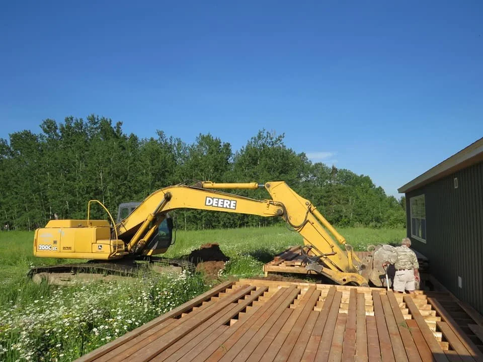
Geothermal at the Conservation Centre
Thanks to a successful grant application to the Ontario Trillium Foundation’s Capital Grants Program in fall 2018, a geothermal heating and cooling system was installed at the Central Algoma Land Trust Conservation Centre. The system has reduced environmental impacts and lowered operational costs at the Conservation Centre. Work began in April 2019 and was completed later that summer.
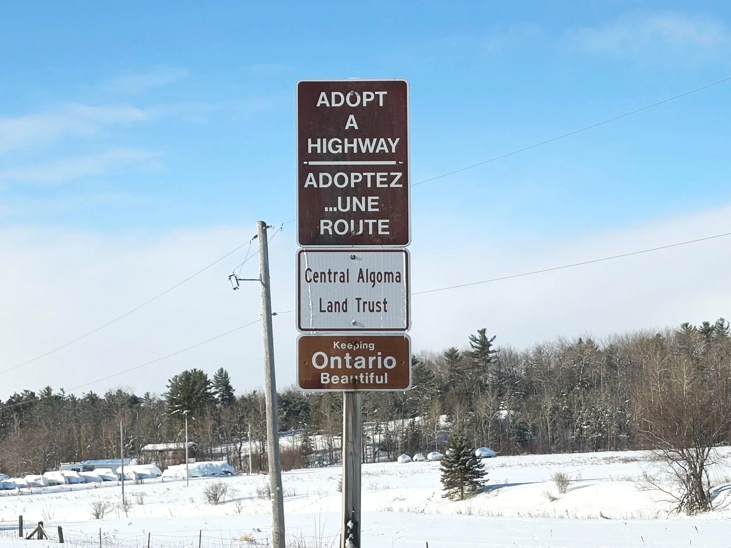
Adopt-a-Highway Program
Ontario’s Adopt-a-Highway program allows businesses, organizations, and individuals, to adopt a section of a provincial highway to help keep our highways clean. We have adopted a three kilometre stretch of Highway 17 between Smith Road and Kensington Road, which is just west of Desbarats. Twice a year, volunteers assist us with picking up litter from along the edge of the highway.
WI Park Restoration Project
The Central Algoma Land Trust partnered with the Township of Tarbutt to restore Women’s Institute Park, located at the south end of MacLennan Road. This included planting native plants, installing signage about plants and wildlife, and setting up an iNaturalist project to create an inventory of the park’s plants and wildlife.
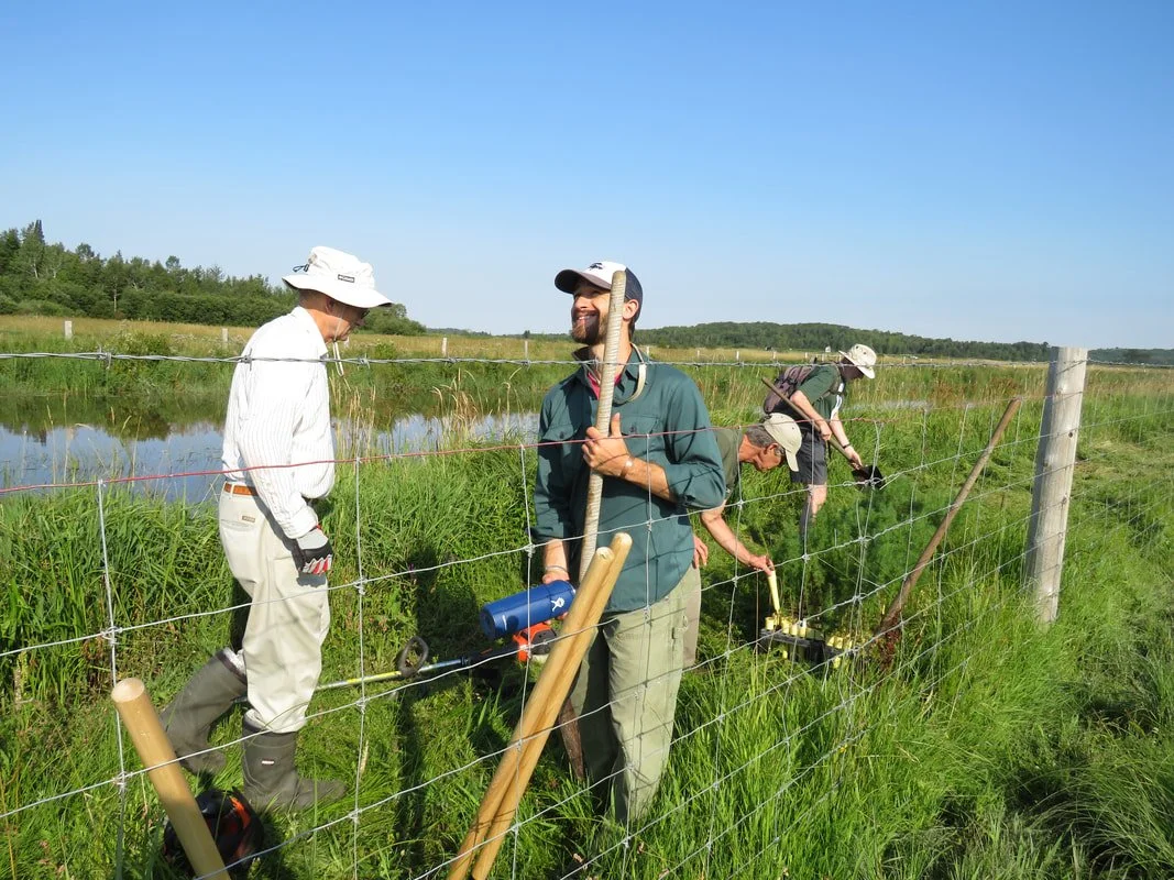
Stobie Creek Rehabilitation Project
The primary goals of the project are to rehabilitate Stobie Creek in order to control sediment, stabilize stream banks, and reduce land loss along the creek caused by erosion. Secondary benefits of achieving these goals include improved water quality and aesthetics, as well as enhanced fish and wildlife habitat. Results to date have included the installation of fencing along the creek to keep cattle out as well as the planting of many trees and shrubs in the riparian zones.
Big Basswood Lake Watershed Species Inventory
We have partnered with the Big Basswood Lake Association to use iNaturalist to create an inventory of plants and wildlife within the Big Basswood Lake Watershed. This community science approach allows residents and visitors to contribute observations and photographs of species they encounter around the lake. Over time, the project will help build a more complete picture of local biodiversity and identify species of interest or conservation concern.
Thessalon Coastal Trail Species Inventory
We are collaborating with the Town of Thessalon to support the Thessalon Coastal Trail, a recreational pathway that showcases the natural beauty of the North Channel waterfront and surrounding landscapes. By encouraging visitors to share their plant and wildlife sightings on iNaturalist, the project helps build a growing record of local biodiversity and strengthens connections between people and the natural environment.
Desbarats Species at Risk Bird Inventory, Education, and Outreach Project
During the summer of 2018, we provided education and outreach on the importance of grassland species at risk birds and how to best protect these species to Desbarats area farmers and other landowners. Data was also collected on the abundance of these species in the area, thier breeding success, and how they interact with their habitats.